


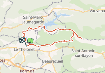
depart cimetiere de le tholonet -montagne sainte victoire

gerardmicheline
User

Length
17.7 km

Max alt
902 m

Uphill gradient
938 m
Km-Effort
30 km

Min alt
222 m

Downhill gradient
936 m
Boucle
Yes
Creation date :
2022-01-19 15:11:32.613
Updated on :
2022-01-19 15:12:36.211
6h51
Difficulty : Very difficult

FREE GPS app for hiking
 SityTrail
IGN / Geographical institutes
SityTrail Plus
The world is yours!
About
Trail Walking of 17.7 km to be discovered at Provence-Alpes-Côte d'Azur, Bouches-du-Rhône, Le Tholonet. This trail is proposed by gerardmicheline.
Positioning
Country:
France
Region :
Provence-Alpes-Côte d'Azur
Department/Province :
Bouches-du-Rhône
Municipality :
Le Tholonet
Location:
Unknown
Start:(Dec)
Start:(UTM)
703222 ; 4822057 (31T) N.
Comments